Fish Stock Survey of Ballyquirke Lough, September 2022
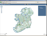
Ballyquirke Lough (Loch Bhaile Ui Choirc) is located approximately 1km south of Moycullen, Co. Galway. The lake is connected to Lough Corrib via the Ballyquirke Canal which exits from the northeast corner of the lake (Figure 1.1). The lake is situated at an altitude of 5 m.a.s.l., has a surface area of 73.6ha, mean depth of 2.9 m and maximum depth of 12.2m. The dominant geology of the lake is limestone and calcareous shale. Adjacent land use is predominantly agricultural with a large
proportion of pasture. The lake is categorised as typology class 6 for the purposes of Water Framework Directive (WFD), i.e., shallow (<4m), greater than 50ha and moderately alkaline (> 20mg/l CaCO3).
The lake falls within the Lough Corrib Special Area of Conservation (SAC) (00297). The SAC supports a number of protected habitats and species including the sea lamprey (Petromyzon marinus), brook
lamprey (Lampetra planeri) and Atlantic salmon (Salmo salar) (NPWS, 2017).
The lake was previously surveyed in 1996 and 2016 when roach, bream, roach x bream hybrid, perch, rudd, rudd x bream hybrid, eel and pike were recorded (CFB, 1997; McLoone et al. 2017). The lake supports an important coarse fish and pike fishery.
This report summarises the results of the 2022 fish stock survey carried out on the lake using Inland Fisheries Ireland’s fish in lakes monitoring protocol. The protocol is WFD compliant and provides insight into fish stock status in the lake.
Topics: Lake Surveys 2022 , Ballyquirke Lough |